
Travel video guide
Things to Do in John Crow Peak: All 3 Spots + Addresses
This guide turns The Maroons | Jamaica's Forgotten Nation from vagabrothers into a practical travel map with 3 saved spots around John Crow Peak and Toms River. The mapped places include a historical landmark, a mountain peak, and a tourist attraction. Use it to understand the places, food notes, and trip context before saving the map in Varedelo.
What the creator captured
Vagabrothers felt privileged to witness the preserved culture of the Maroons, who maintained their autonomy through the rugged, impassable terrain of the Blue Mountains. They were particularly impressed by the community's deep knowledge of the land and the military-style social structure that remains a testament to their history of resistance. The duo highlighted the transition of the village into a sustainable tourist destination that shares its unique heritage through cultural experiences.
What this map is good for
- Planning a mountain peak stop or short itinerary in John Crow Peak.
- Seeing where the mapped places sit together before choosing what to visit first.
- Saving 3 mapped spots into Varedelo so the list stays usable on the ground.
- Using the original video as context, then turning it into a clean place-by-place map.
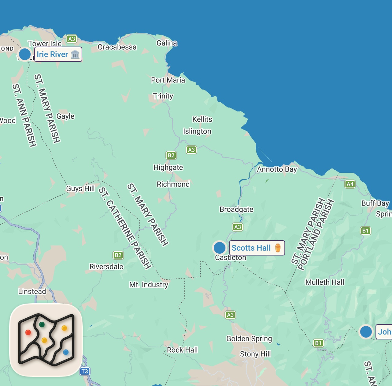
Featured spots on this map
- Irie River
Tourist Attraction in Exchange Main Road, Exchange, Jamaica, Exchange Main Road, Exchange, Jamaica - John Crow Peak
Mountain Peak in John Crow Peak, Jamaica, John Crow Peak, Jamaica - Scotts Hall
Historical Landmark in 55P8+C6, Toms River, Jamaica, Toms River, Jamaica
Food notes from the video
- ripe apples
- plum-like fruit
- potable river water
Experiences captured
- met Colonel Pink at Scotts Hall Maroon Town
- heard the blowing of the Abeng horn
- rode in the back of a flatbed truck
- traversed rugged jungle terrain and dirt roads
- hiked to the Irie River
- learned about medicinal and edible jungle plants
- visited a waterfall used as a historic village entrance
- observed traditional spear gun fishing
Planning questions
What are the best spots in John Crow Peak from this video?
This guide maps all 3 spots featured in the video, with names, addresses, and neighborhoods, so you can plan your trip to John Crow Peak.
What are the must-try foods in John Crow Peak?
Creator picks from the video include ripe apples, plum-like fruit, potable river water. Open the map in Varedelo to see which spot each one is at.
Can I save these spots to use on my trip?
Yes. Open the map in Varedelo to save every spot, get directions, and revisit the guide from your phone while you travel.
Use it on your trip
Save this travel map before you go
Keep the mapped spots, creator context, food notes, and planning details together. Varedelo turns the page into a phone-friendly map you can revisit when you are choosing where to go.