
Travel video guide
Where to Eat in Co. Clare: All 27 Spots + Addresses
This guide turns 🇮🇪 Irland Dokumentation | Was sie dir über Europa nie erzählt haben | 4K from Welt Entdecken into a practical food map with 27 saved spots around Co. Clare, Ennis, and Letterfrack. The mapped places include a national park, a park, a historical landmark, and a place marker. Use it to understand the places, dishes, and trip context before saving the map in Varedelo.
What the creator captured
Welt Entdecken emphasizes that Ireland is a place where nature acts as a living character rather than a mere backdrop, leaving visitors feeling small against its vast landscapes. The creator was particularly moved by the intersection of geological science and ancient legends at sites like the Giant's Causeway. Ultimately, the video conveys that Ireland's true essence cannot be captured in photos but must be felt through its wind, silence, and rugged coastal beauty.
What this map is good for
- Planning a national park stop or short itinerary in Co. Clare.
- Comparing food stops from a creator or saved local map before you commit time in the city.
- Saving 27 mapped spots into Varedelo so the list stays usable on the ground.
- Using the original video as context, then turning it into a clean place-by-place map.
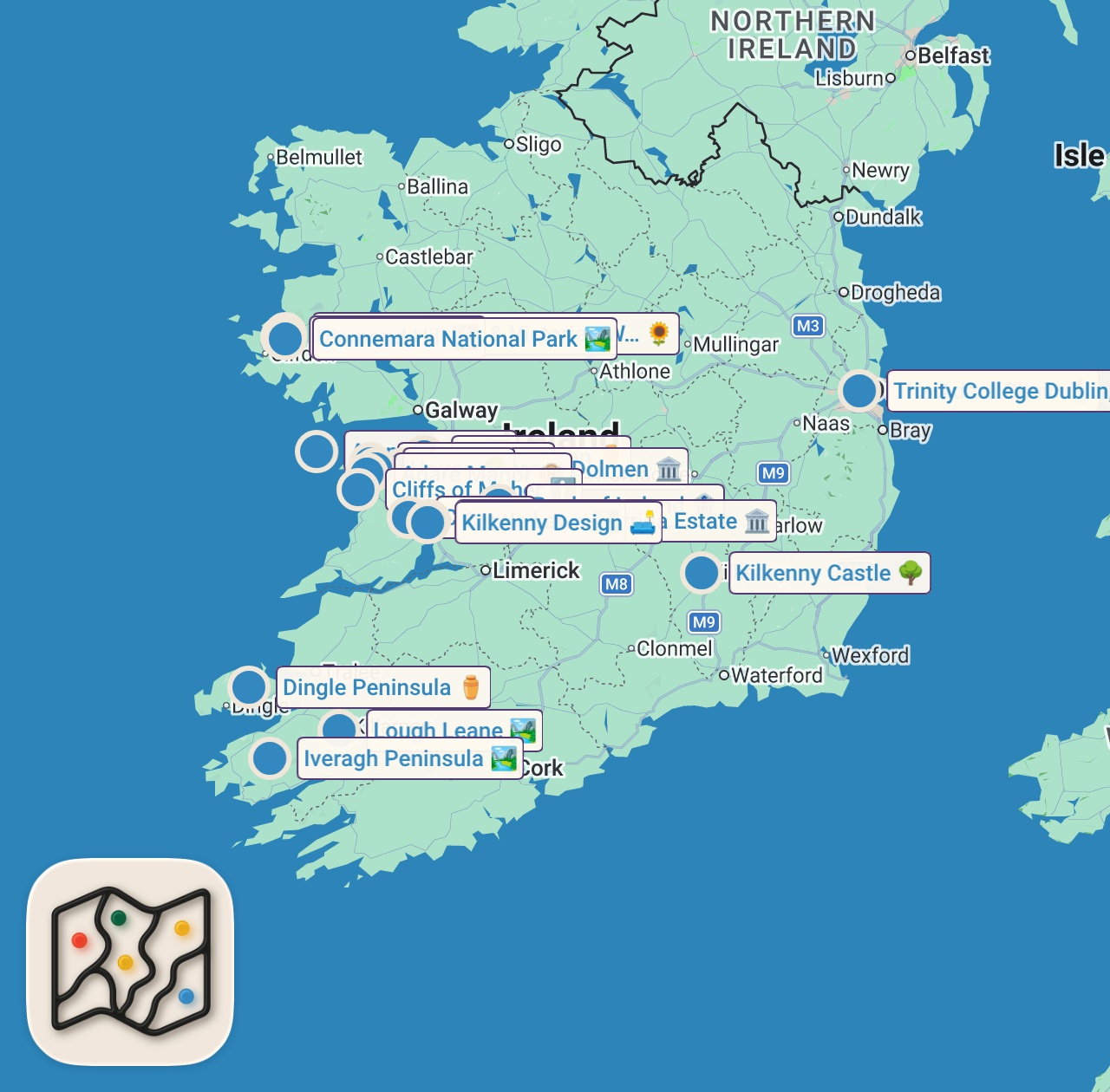
Featured spots on this map
- Poulnabrone Dolmen
Tourist Attraction in Clare, Poulnabrone, Co. Clare, Ireland, Poulnabrone, Co. Clare, Ireland
Hours: Hours available - The Burren
National Park in Ballyryan, Co. Clare, Ireland, Ballyryan, Co. Clare, Ireland
Hours: Hours available - Bank of Ireland
Bank in Ballyminoge, Bridge Street, Co. Clare, V94 VOF9, Ireland, Co. Clare, V94 VOF9, Ireland - Clare
Park in Clare, Co. Clare, Ireland, Clare, Co. Clare, Ireland - Kilkenny Design
Home Goods Store in 5 High St, Clonroad Beg, Ennis, Co. Clare, V95 VX26, Ireland, Co. Clare, V95 VX26, Ireland - Dingle Peninsula
Historical Landmark in Dingle Peninsula, Co. Kerry, Ireland, Dingle Peninsula, Co. Kerry, Ireland - The Adare Clinic
Skin Care Clinic in 4 Clare St, Dublin 2, D02 VH36, Ireland, Dublin, D02 VH36, Ireland - Kylemore Abbey & Victorian Walled Garden
Garden in Pollacappul, Co. Galway, Ireland, Pollacappul, Co. Galway, Ireland - Cliffs of Moher
Visitor Center in Cliffs of Moher, Co. Clare, Ireland, Cliffs of Moher, Co. Clare, Ireland - Kilkenny Castle
Park in The Parade, Dukesmeadows, Kilkenny, R95 YRK1, Ireland, Kilkenny, R95 YRK1, Ireland - Iveragh Peninsula
National Park in Iveragh Peninsula, Co. Kerry, Ireland, Iveragh Peninsula, Co. Kerry, Ireland - Dunluce
Place marker in Dunluce, Clon Rd, Clonroad More, Ennis, Co. Clare, Ireland, Ennis, Co. Clare, Ireland - 15 more spots
Open the map in Varedelo to see the full saved list.
Experiences captured
- Hiked along the 214-meter high Cliffs of Moher
- Walked on the hexagonal basalt columns of Giant's Causeway
- Drove along the 2500 km Wild Atlantic Way
- Crossed the swaying Carrick-a-Rede Rope Bridge
- Observed nesting seabirds from a small coastal island
- Navigated the 180 km Ring of Kerry scenic route
- Viewed the Lakes of Killarney from Ladies View
- Encountered a shepherd and sheep herd on the road
Official tourism resource
The official tourism website for County Clare, Ireland, managed by the Tourism Department of Clare County Council to showcase the region's attractions.
Planning questions
Where did Welt Entdecken eat in Co. Clare?
This guide maps all 27 spots featured in the video, with names, addresses, and neighborhoods, so you can plan where to eat in Co. Clare.
Can I save these spots to use on my trip?
Yes. Open the map in Varedelo to save every spot, get directions, and revisit the guide from your phone while you travel.
Use it on your trip
Save this food map before you go
Keep the mapped spots, creator context, food notes, and planning details together. Varedelo turns the page into a phone-friendly map you can revisit when you are choosing where to go.