Varedelo Varedelo
Video guide

Loading the map

Check off each spot — free in the app

Free · check spots off as you go with AI

Live concierge

What's worth your time near here — right now

Unlock live picks — free in the app

Travel video guide

Things to Do in Bremm: 3 Places From marlenesleben

This guide turns Deutschlands steilster Wanderweg: Calmont-Klettersteig an der Mosel from marlenesleben into a practical travel map with 3 saved spots around Bremm and Ediger-Eller. The mapped places include a historical landmark, a mountain peak, and a scenic spot. Use it to understand the places, food notes, and trip context before saving the map in Varedelo.

LocationBremm, Rhineland-Palatinate, Germany
FocusTravel Map
Mapped places3 spots
Sourcemarlenesleben

What the creator captured

marlenesleben successfully conquered the steepest hiking trail in Germany, navigating 360 meters of elevation with gradients up to 65 degrees. She was particularly impressed by the unique microclimate of the 'hot mountain' and the stunning panoramic view of the Moselle Loop from the summit. The experience concluded with a rewarding glass of local Riesling, which she noted is still harvested by hand in these extreme conditions.

What this map is good for

  • Planning a mountain peak stop or short itinerary in Bremm.
  • Seeing where the mapped places sit together before choosing what to visit first.
  • Saving 3 mapped spots into Varedelo so the list stays usable on the ground.
  • Using the original video as context, then turning it into a clean place-by-place map.
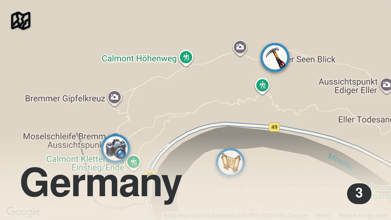
Map of 3 spots from Deutschlands steilster Wanderweg: Calmont-Klettersteig an der Mosel

Featured spots on this map

  • Calmont
    Mountain Peak in Calmont, 56814 Ediger-Eller, Germany, Cochem-Zell, Ediger-Eller, Rhineland-Palatinate, Germany
  • Kloster Ruine Stuben
    Historical Landmark in 56814 Bremm, Germany, Cochem-Zell, Bremm, Rhineland-Palatinate, Germany
    Hours: Hours available
  • Moselschleife Bremm Aussichtspunkt
    Scenic Spot in 56814 Bremm, Germany, Cochem-Zell, Bremm, Rhineland-Palatinate, Germany
    Hours: Hours available

Food notes from the video

  • Snacks

Experiences captured

  • Climbed the Calmont Klettersteig via ferrata
  • Hiked through Europe's steepest vineyard
  • Navigated narrow paths along steep cliffs
  • Climbed metal ladders and used wire rope protections
  • Passed the 'Ella Todesangst' flag point
  • Viewed the Moselle Loop (Moselschleife) from the summit
  • Walked along a narrow mountain ridge
  • Visited a wine tavern in the valley

Official tourism resource

The official tourism portal for Bremm, featuring information on the Calmont region, the steepest vineyard in Europe, and local wine culture.

Bremm-Mosel ↗

Planning questions

What are the best spots in Bremm, Rhineland-Palatinate from this video?

This guide maps all 3 spots featured in the video, with names, addresses, and neighborhoods, so you can plan your trip to Bremm, Rhineland-Palatinate.

What are the must-try foods in Bremm, Rhineland-Palatinate?

Creator picks from the video include Snacks. Open the map in Varedelo to see which spot each one is at.

Can I save these spots to use on my trip?

Yes. Open the map in Varedelo to save every spot, get directions, and revisit the guide from your phone while you travel.

Use it on your trip

Save this travel map before you go

Keep the mapped spots, creator context, food notes, and planning details together. Varedelo turns the page into a phone-friendly map you can revisit when you are choosing where to go.

Varedelo trip map
3 mapped spots
Travel Map marlenesleben Video Map
Check off each spot — free in the app

Video Highlights

Get the full experience in the app

Save This Map