Travel video guide
Best Parks in Tongariro Alpine Crossing, Manawatū-Whanganui
This guide turns New Zealand's Best Hike | Tongariro Alpine Crossing Travel Vlog from vagabrothers into a practical parks map with 1 saved spot around Tongariro Alpine Crossing. The mapped places include a national park. Use it to understand the places, food notes, and trip context before saving the map in Varedelo.
What the creator captured
vagabrothers completed the challenging Tongariro Alpine Crossing, reaching a peak altitude of 1,800 meters despite accidentally leaving their sandwiches behind. Alex was particularly struck by the geologically active landscape and the spiritual significance of the 'tapu' volcanic peaks to the Maori people. He emphasized the importance of being over-prepared for the slippery volcanic descent and respecting the park's sacred history.
What this map is good for
- Planning a national park stop or short itinerary in Tongariro Alpine Crossing.
- Seeing where the mapped places sit together before choosing what to visit first.
- Saving 1 mapped spot into Varedelo so the list stays usable on the ground.
- Using the original video as context, then turning it into a clean place-by-place map.
Featured spots on this map
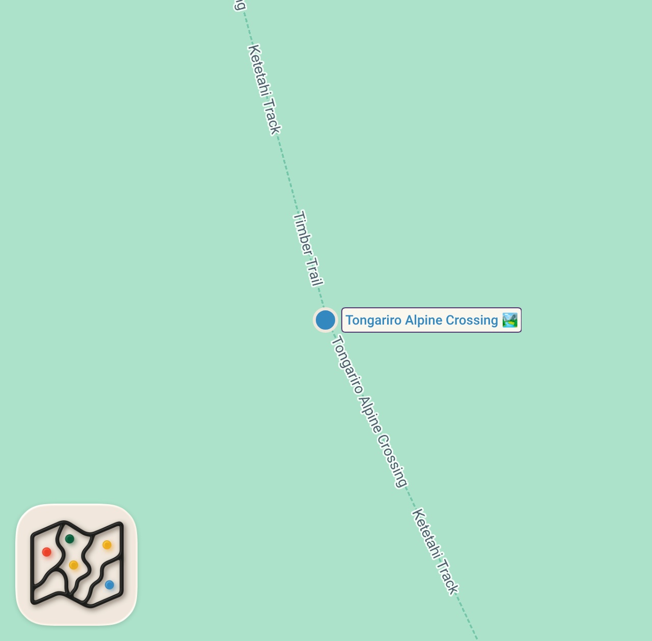
- Tongariro Alpine Crossing
National Park in Tongariro Alpine Crossing, Manawatū-Whanganui, New Zealand
Food notes from the video
- apples
- power bars
Experiences captured
- hiked 19.4 km through Tongariro National Park
- viewed Mount Ngauruhoe (Mount Doom)
- walked through alpine scrub and purple flowers
- reached the summit of Red Crater Ridge
- observed volcanic calderas and oxidized red soil
- descended through slippery volcanic dust and rock
- experienced high altitude breathing changes
- learned about Maori creation myths and sacred sites
Planning questions
What is this video map?
It is a crawlable guide to the mapped places from New Zealand's Best Hike | Tongariro Alpine Crossing Travel Vlog, with the creator video, a static map preview, and selected spots from the trip.
Can I save these spots?
Yes. Open the map in Varedelo to save the places, keep planning notes, and revisit the guide from your phone.
Does this replace watching the video?
No. The video remains the source, and the map makes the places easier to scan, compare, and save while planning.
Use it on your trip
Save this parks map before you go
Keep the mapped spots, creator context, food notes, and planning details together. Varedelo turns the page into a phone-friendly map you can revisit when you are choosing where to go.