
Travel video guide
Tales From Abroad in Vestland: 9 Spots
This guide turns Top 10 Places in Norway That Look Unreal (You Need to See #8!) from Tales From Abroad into a practical travel map with 9 saved spots around Stryn Municipality, Lysebotn, and Røldal. The mapped places include an area marker, a scenic spot, a lake, and a mountain peak. Use it to understand the places, food notes, and trip context before saving the map in Varedelo.
What the creator captured
Tales From Abroad considers the demanding 9-hour climb of Mount Slogen to be the most epic and rewarding hike he has ever completed in Europe. While he found the final summit too dangerous to finish, the 360-degree views of glaciers and fjords remained his ultimate highlight. He also emphasized that the dramatic contrast between the raw nature of the fjords and the vibrant energy of Oslo makes Norway a diverse destination.
What this map is good for
- Planning a scenic spot stop or short itinerary in Stryn Municipality.
- Seeing where the mapped places sit together before choosing what to visit first.
- Saving 9 mapped spots into Varedelo so the list stays usable on the ground.
- Using the original video as context, then turning it into a clean place-by-place map.
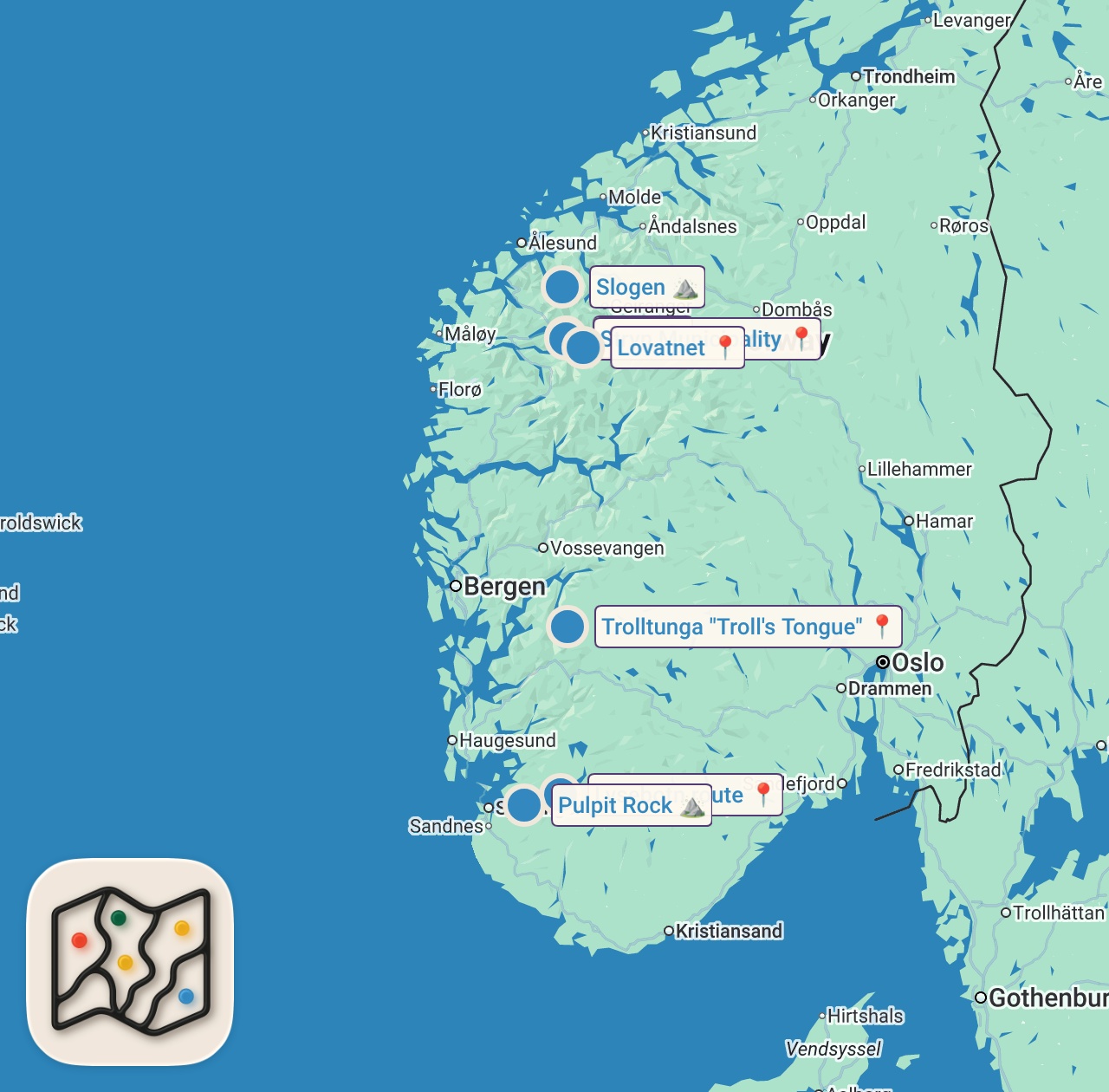
Featured spots on this map
- Pulpit Rock
Natural Feature in Pulpit Rock, Strand, Norway, Strand, Rogaland, Norway - Stryn
Area marker in Stryn, Norway, Stryn, Vestland, Norway - Lysebotn route
Scenic Spot in Lysevegen 745, 4127 Lysebotn, Norway, Lysebotn, Rogaland, Norway
Hours: Hours available - Stryn Municipality
Area marker in Stryn Municipality, Norway, Stryn Municipality, Vestland, Norway - Trolltunga "Troll's Tongue"
Scenic Spot in Trolltunga, 5750 Odda, Norway, Røldal, Vestland, Norway
Hours: Hours available - Senja
Area marker in Senja, Norway, Senja, Troms, Norway - Lovatnet
Lake in Lovatnet, Stryn Municipality, Norway, Stryn Municipality, Vestland, Norway - Slogen
Mountain Peak in Slogen, Ørsta Municipality, Norway, Ørsta Municipality, Møre og Romsdal, Norway - Svalbard
Area marker in Svalbard, Svalbard and Jan Mayen, Svalbard, Svalbard and Jan Mayen
Food notes from the video
- beers
Experiences captured
- Hiked from Opine to Luan Skyft
- Flew a drone at Lake Lovatnet
- Stayed at Sande Camping
- Completed a 9-hour climb of Mount Slogen
- Walked on the roof of Oslo Opera House
- Drove the 27 hairpin turns of Lysevegen
- Hiked to the Pulpit Rock viewpoint
- Explored the fishing villages of Lofoten
Official tourism resource
The official destination marketing organization for the Nordfjord region, including Stryn Municipality, providing travel guides and visitor information.
Planning questions
What are the best spots in Vestland from this video?
This guide maps all 9 spots featured in the video, with names, addresses, and neighborhoods, so you can plan your trip to Vestland.
What are the must-try foods in Vestland?
Creator picks from the video include beers. Open the map in Varedelo to see which spot each one is at.
Can I save these spots to use on my trip?
Yes. Open the map in Varedelo to save every spot, get directions, and revisit the guide from your phone while you travel.
Use it on your trip
Save this travel map before you go
Keep the mapped spots, creator context, food notes, and planning details together. Varedelo turns the page into a phone-friendly map you can revisit when you are choosing where to go.