
Travel video guide
Best Parks in Co. Donegal From vagabrothers
This guide turns BETTER THAN THE CLIFFS OF MOHER IRELAND | Northern Ireland Road Trip Series Ep.1 from vagabrothers into a practical parks map with 3 saved spots around Buncrana, Co. Donegal, and Shanbally. The mapped places include a place marker and a national park. Use it to understand the places, food notes, and trip context before saving the map in Varedelo.
What the creator captured
Vagabrothers explored the rugged coastline of County Donegal, highlighting the intense physical experience of coasteering and the immense scale of the Slieve League cliffs. They were particularly moved by the deep historical roots of the region, from the geological connection to North America to the sixth-generation tradition of Donegal tweed weaving. The duo emphasized that the combination of powerful nature and local craftsmanship represents the true beauty of Ireland.
What this map is good for
- Planning a national park stop or short itinerary in Buncrana.
- Seeing where the mapped places sit together before choosing what to visit first.
- Saving 3 mapped spots into Varedelo so the list stays usable on the ground.
- Using the original video as context, then turning it into a clean place-by-place map.
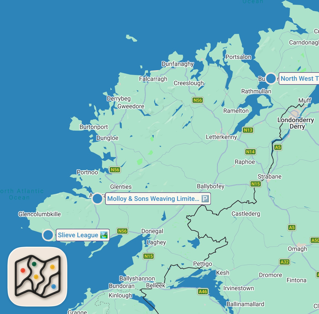
Featured spots on this map
- Molloy & Sons Weaving Limited
Place marker in Mogumna, Ardara, Co. Donegal, F94 C6P9, Ireland, Co. Donegal, F94 C6P9, Ireland - North West Transport
Place marker in Upper Main St, Ardaravan, Buncrana, Co. Donegal, Ireland, Buncrana, Co. Donegal, Ireland - Slieve League
National Park in Slieve League, Shanbally, Co. Donegal, Ireland, Shanbally, Co. Donegal, Ireland
Food notes from the video
- seafood platter
- crab
- lobster
- mussels
- seafood chowder
- sea spaghetti with lemon sauce
Experiences captured
- went coasteering in Mullaghmore
- jumped off cliffs into the ocean
- explored coastal caves
- dined at Eithna's By The Sea
- hiked the Slieve League sea cliffs
- visited a sixth-generation tweed weaving business
- met with local weavers at Molloy and Sons
Official tourism resource
The official tourism website for the Inishowen Peninsula, including Buncrana, funded by Donegal County Council and the Department of Rural & Community Development.
Planning questions
What is this video map?
It is a crawlable guide to the mapped places from BETTER THAN THE CLIFFS OF MOHER IRELAND | Northern Ireland Road Trip Series Ep.1, with the creator video, a static map preview, and selected spots from the trip.
Can I save these spots?
Yes. Open the map in Varedelo to save the places, keep planning notes, and revisit the guide from your phone.
Does this replace watching the video?
No. The video remains the source, and the map makes the places easier to scan, compare, and save while planning.
Use it on your trip
Save this parks map before you go
Keep the mapped spots, creator context, food notes, and planning details together. Varedelo turns the page into a phone-friendly map you can revisit when you are choosing where to go.