Varedelo
Video guide

Loading the map

Check off each spot — free in the app

Free · check spots off as you go with AI

Live concierge

What's worth your time near here — right now

Unlock live picks — free in the app

Travel video guide

Things to Do in Occitanie: All 4 Spots + Addresses

This guide turns Vicdessos, Pyrénées - visite à pied 4K - Belle balade en forêt sauvage et apaisante au bord de l'eau from Échappées Montagnardes - trek et randonnées 🏔️ into a practical travel map with 4 saved spots around Auzat, Montels, and Tarascon-sur-Ariège. The mapped places include an area marker, a mountain peak, and a national park. Use it to understand the places and trip context before saving the map in Varedelo.

LocationOccitanie, France
FocusTravel Map
Mapped places4 spots
SourceÉchappées Montagnardes - trek et randonnées 🏔️

What the creator captured

Échappées Montagnardes - trek et randonnées 🏔️ focused on capturing the calm and natural beauty of the Ariège region at an altitude of 600 meters. The creator highlighted the scenic transition of water from the high Pyrenean peaks through the Laramade pipe to the valley's hydroelectric station. The journey emphasized the peaceful experience of walking through forests and alongside the Vicdessos stream.

What this map is good for

  • Planning a mountain peak stop or short itinerary in Auzat.
  • Seeing where the mapped places sit together before choosing what to visit first.
  • Saving 4 mapped spots into Varedelo so the list stays usable on the ground.
  • Using the original video as context, then turning it into a clean place-by-place map.
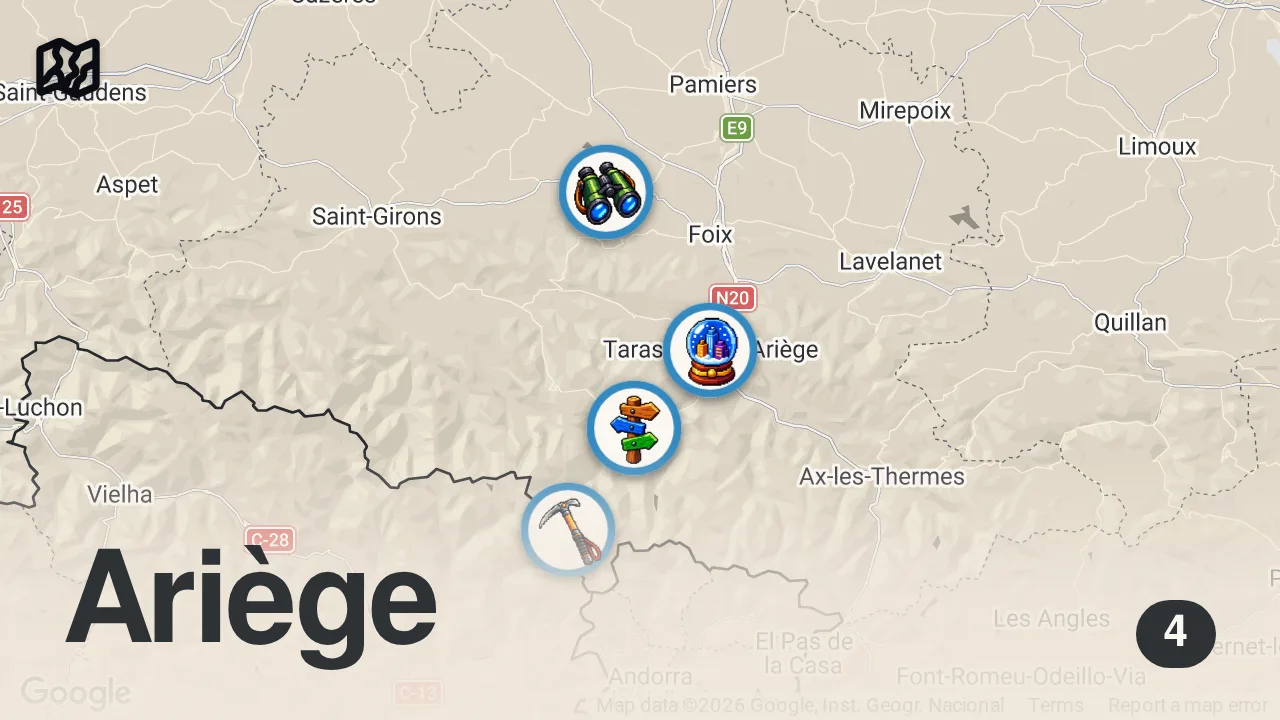
Map of 4 spots from Vicdessos, Pyrénées - visite à pied 4K - Belle balade en forêt sauvage et apaisante au bord de l'eau

Featured spots on this map

  • Parc naturel régional des Pyrénées Ariégeoises
    National Park in Pôle d’activités – Ferme d’Icart, 09240 Montels, France, Montels, Occitanie, France
    Hours: Hours available
  • Tarascon-sur-Ariège
    Area marker in 09400 Tarascon-sur-Ariège, France, Tarascon-sur-Ariège, Occitanie, France
  • Montcalm Massif
    Mountain Peak in Montcalm Massif, 09220 Auzat, France, Auzat, Occitanie, France
  • Vicdessos
    Sublocality Level 1 in Vicdessos, 09220 Val-de-Sos, France, Vicdessos, Occitanie, France

Experiences captured

  • Hiked in the Vicdessos valley
  • Explored the Montcalm massif area
  • Walked along forest trails
  • Filmed a 2.5 kilometer journey
  • Observed the Laramade water pipe
  • Walked along the Vicdessos river
  • Visited the hydroelectric power station area

Planning questions

What are the best spots in Occitanie from this video?

This guide maps all 4 spots featured in the video, with names, addresses, and neighborhoods, so you can plan your trip to Occitanie.

Can I save these spots to use on my trip?

Yes. Open the map in Varedelo to save every spot, get directions, and revisit the guide from your phone while you travel.

Use it on your trip

Save this travel map before you go

Keep the mapped spots, creator context, food notes, and planning details together. Varedelo turns the page into a phone-friendly map you can revisit when you are choosing where to go.

Varedelo trip map
4 mapped spots
Travel Map Échappées Montagnardes - trek et randonnées 🏔️ Video Map
Check off each spot — free in the app

Video Highlights

Get the full experience in the app

Save This Map