
Travel video guide
Sanda Travels in China: 18 Spots From the Video
This guide turns CHINA: 10 of the Most Beautiful Places to Visit at All Prices | 4K Travel Guide from Sanda Travels into a practical food map with 18 saved spots around Gansu, Hunan, and Zhangye. The mapped places include a tourist attraction, a mountain peak, a park, and a national park. Use it to understand the places, dishes, and trip context before saving the map in Varedelo.
What the creator captured
Sanda Travels showcases China as a land where ancient history and surreal natural landscapes coexist, specifically highlighting the spiritual significance of sacred mountains like Emei and Wudang. The creator emphasizes that beyond iconic landmarks, the country's true magic lies in its diverse cultural heritage, from traditional tea ceremonies to the architectural marvels of the Hani people.
What this map is good for
- Planning a mountain peak stop or short itinerary in Gansu.
- Comparing food stops from a creator or saved local map before you commit time in the city.
- Saving 18 mapped spots into Varedelo so the list stays usable on the ground.
- Using the original video as context, then turning it into a clean place-by-place map.
Featured spots on this map
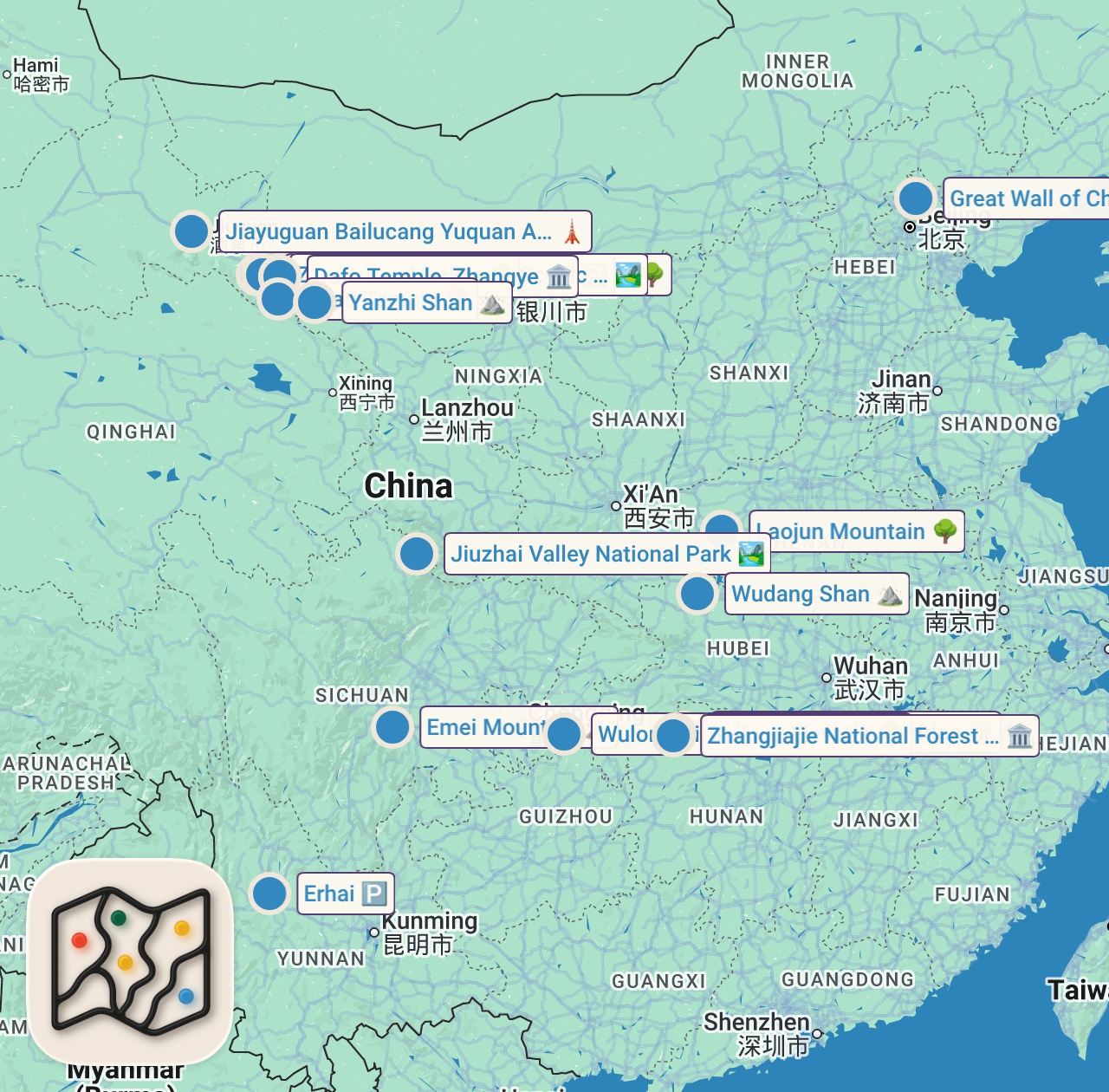
- Erhai
Place marker in Erhai, Dali, China, Erhai, Dali, China - Ganzhou Market
Market in China, Gansu, Zhangye, Ganzhou District, 金脉步行街 邮政编码: 734099, Zhangye, Ganzhou District, 金脉步行街 邮政编码: 734099 - Laojun Mountain
Park in Luanchuan County, Luoyang, China, 471599, Luoyang, China, 471599 - Zhangye National Wetland Park
Park in XCCR+Q9G, 312 Guo Dao, Ganzhou District, Zhangye, Gansu, China, 734099, Gansu, China, 734099 - Yanzhi Shan
Mountain Peak in Shandan County, Zhangye, China, 734104, Zhangye, China, 734104 - Binggou Danxia Scenic Spot
Place marker in XWG4+9F9, Sunan Yugur Autonomous County, Zhangye, Gansu, China, 734404, Gansu, China, 734404 - Dafo Temple, Zhangye
Tourist Attraction in China, Gansu, Zhangye, Ganzhou District, Dafosi Ln, 大佛寺巷 邮政编码: 734099, Ganzhou District, Dafosi Ln, 大佛寺巷 邮政编码: 734099 - Jiayuguan Bailucang Yuquan Anc. St
Landmark in China, Gansu, Jiayuguan City, Jiayuguan, 1059, 西南方向60米 邮政编码: 735100, Jiayuguan, 1059, 西南方向60米 邮政编码: 735100 - Wulong District
Nature in Wulong District, Chongqing, China, Wulong District, Chongqing, China - Jiuzhai Valley National Park
National Park in Jiuzhaigou County, Ngawa Tibetan and Qiang Autonomous Prefecture, Sichuan, China, 623402, Sichuan, China, 623402 - Wudang Shan
Mountain Peak in Danjiangkou, Shiyan, China, 442715, Shiyan, China, 442715 - Zhangjiajie National Forest Park
Tourist Attraction in Wulingyuan District, Zhangjiajie, Hunan, China, 427403, Wulingyuan District, Hunan, China - 6 more spots
Open the map in Varedelo to see the full saved list.
Food notes from the video
- Green tea
- Black tea
- Oolong tea
- Pu'er tea
Experiences captured
- Visited Mount Emei Buddhist temples
- Explored Harbin Ice and Snow Festival
- Viewed turquoise lakes in Jiuzhaigou Valley
- Observed Yuanyang Hani Rice Terraces
- Hiked Mount Laojun Taoist site
- Crossed the glass-bottomed Ruyi Bridge
- Saw Zhangjiajie's floating avatar mountains
- Walked the Great Wall of China
Official tourism resource
The official English-language portal for Gansu, China, providing comprehensive travel guides, cultural insights, and visitor information for the province.
Planning questions
Where did Sanda Travels eat in China?
This guide maps all 18 spots featured in the video, with names, addresses, and neighborhoods, so you can plan where to eat in China.
What are the must-try foods in China?
Creator picks from the video include Green tea, Black tea, Oolong tea, Pu'er tea. Open the map in Varedelo to see which spot each one is at.
Can I save these spots to use on my trip?
Yes. Open the map in Varedelo to save every spot, get directions, and revisit the guide from your phone while you travel.
Use it on your trip
Save this food map before you go
Keep the mapped spots, creator context, food notes, and planning details together. Varedelo turns the page into a phone-friendly map you can revisit when you are choosing where to go.