
Travel video guide
Things to Do in Casuarina Rd, Malindi: 4 Places
This guide turns Traveling To Kenya's Donkey Island — Muslim-majority Island Of Lamu 🇰🇪 (Swahili & Islamic Culture) from Davud Akhundzada into a practical travel map with 4 saved spots around Casuarina Rd. The mapped places include an airport, a historical landmark, a national park, and a park. Use it to understand the places and trip context before saving the map in Varedelo.
What the creator captured
Davud Akhundzada was fascinated by the unique transit experience of landing at a tiny airport and immediately boarding a boat to reach the car-free 'Donkey Island.' He was particularly impressed by the narrow streets of Lamu and the fact that donkeys serve as the primary mode of transport for both people and construction materials. He described the island as a 'small paradise' and was warmly welcomed by the local Muslim and Christian community.
What this map is good for
- Planning a national park stop or short itinerary in Casuarina Rd.
- Seeing where the mapped places sit together before choosing what to visit first.
- Saving 4 mapped spots into Varedelo so the list stays usable on the ground.
- Using the original video as context, then turning it into a clean place-by-place map.
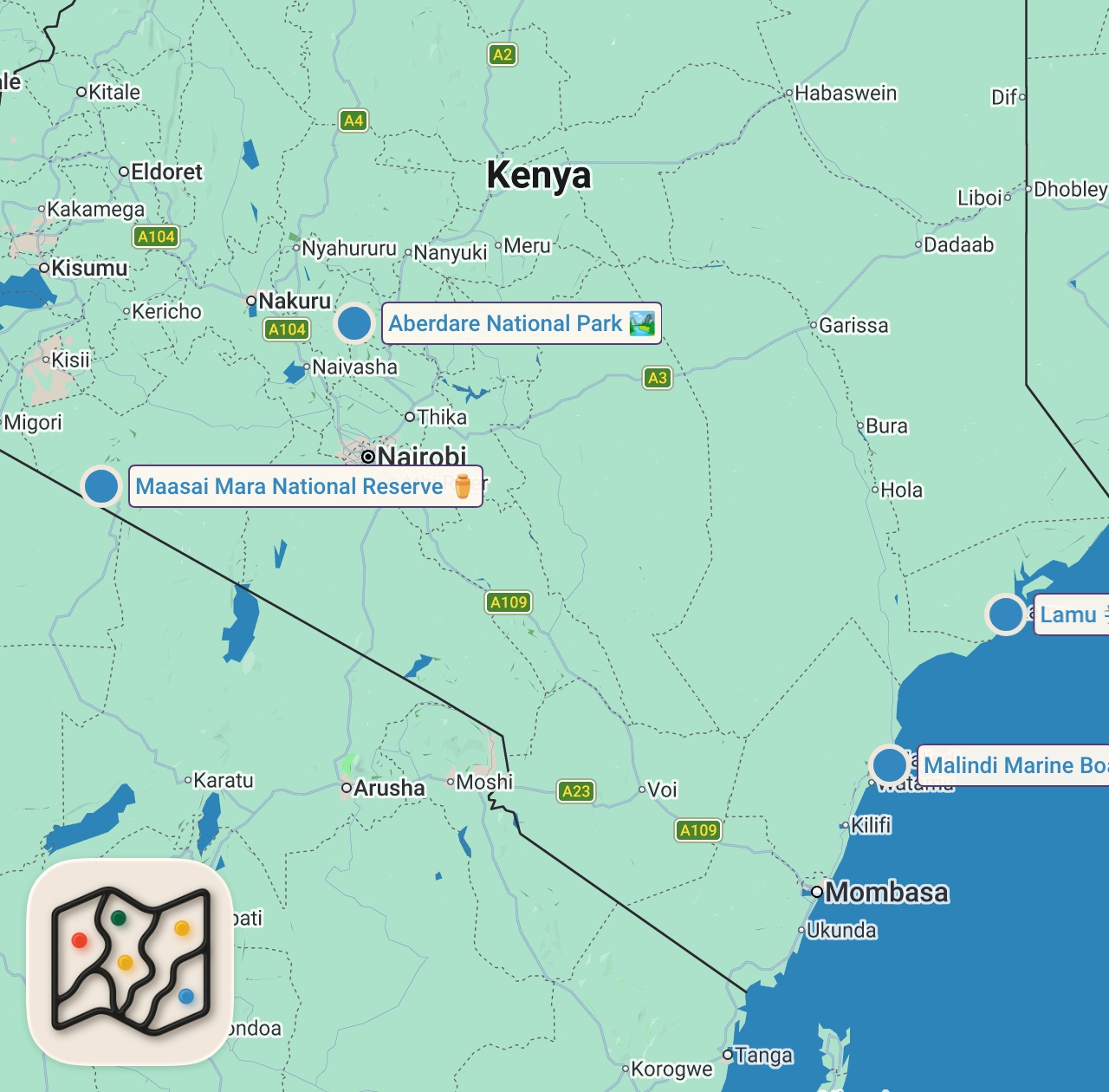
Featured spots on this map
- Malindi Marine Boat Excursions
Park in Marinepark Rd, Casuarina Rd, Malindi, Kenya, Casuarina Rd, Malindi, Kenya
Hours: Hours available - Maasai Mara National Reserve
Historical Landmark in Kenya
Hours: Hours available - Lamu
Airport in Kenya - Aberdare National Park
National Park in Kenya
Hours: Hours available
Experiences captured
- Flew from Nairobi to Manda Airport with Jambojet
- Experienced a small, house-like airport terminal
- Met a pre-arranged hotel pickup driver
- Walked from the airport to the boat dock
- Took a 5-6 minute boat ride to Lamu Island
- Observed donkeys used as the main local transportation
- Arrived at the Lamu Island port during heavy rain
- Explored the narrow streets of the UNESCO World Heritage site
Planning questions
What is this video map?
It is a crawlable guide to the mapped places from Traveling To Kenya's Donkey Island — Muslim-majority Island Of Lamu 🇰🇪 (Swahili & Islamic Culture), with the creator video, a static map preview, and selected spots from the trip.
Can I save these spots?
Yes. Open the map in Varedelo to save the places, keep planning notes, and revisit the guide from your phone.
Does this replace watching the video?
No. The video remains the source, and the map makes the places easier to scan, compare, and save while planning.
Use it on your trip
Save this travel map before you go
Keep the mapped spots, creator context, food notes, and planning details together. Varedelo turns the page into a phone-friendly map you can revisit when you are choosing where to go.